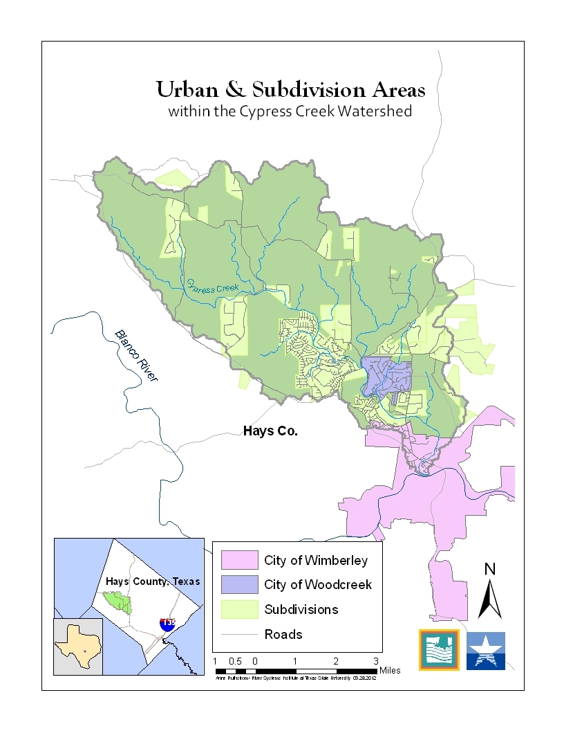
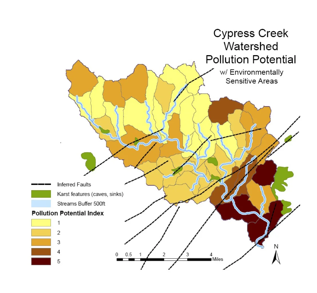
Maps of the Cypress Creek Watershed


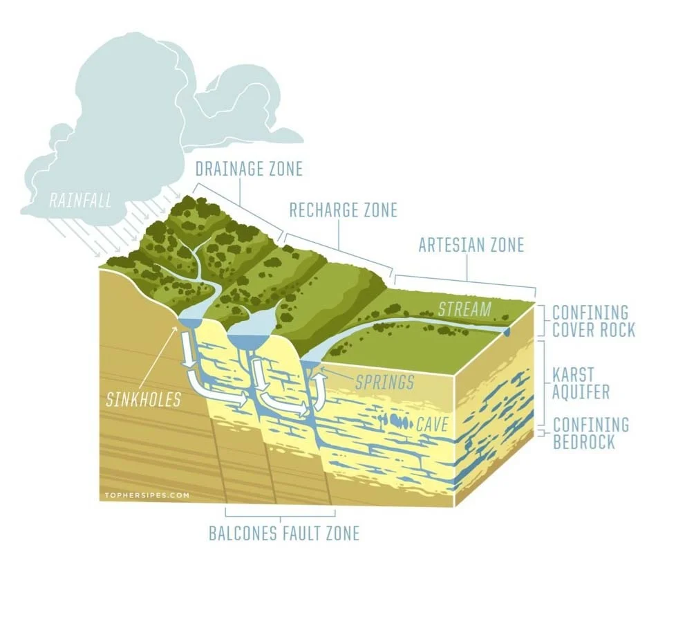
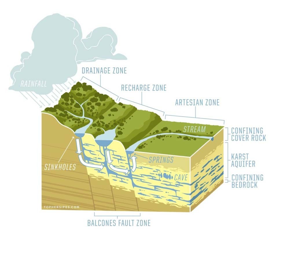
Diagrams of the Cypress Creek Watershed

Other maps and Diagrams
Billion-Dollar Weather and Climate Disasters Mapping
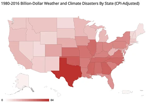
"To better visualize the spatial dimensions of Billion-dollar weather and climate events, this map is an interactive event frequency mapping tool." It "provides a customizable range of years and disaster types, to help visualize how disaster costs change over space and time."